
Steubenville Marina Shared Use Path 2020
Bike / Ped Path To Reach Steubenville Marina in 2020
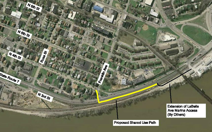
To help create additional use opportunities for the Steubenville Marina, a shared used bike/pedestrian path will be built in 2020. The path will connect the Ohio Riverfront to Historic N. Fourth Street, providing a vital connection for bicycles and pedestrians between the City of Steubenville street/walkway system and the Steubenville Marina.
This is a Transportation Alternatives Program project, which is including in the BHJ Transportation Improvement Plan (TIP). The proposed work, visible above via the yellow line, will construct a shared use path (bicycle and pedestrian) from the intersection of Franklin Avenue and North 4th Street to the newly relocated Marina Access Road (aka LaBelle Avenue) within the City of Steubenville.
Work will include the construction of paved shared use path, dry laid retaining wall, fencing, curb ramp construction, minor drainage, pavement markings, traffic control signs, and the modification of traffic signals at Franklin Avenue to include the addition of pedestrian signals and pedestrian detection.
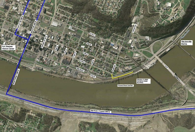
This project is one building block in the construction of an interconnected system of trails, walkways and bike routes in Jefferson County following the Jefferson County Trails and Greenway Plan prepared in 2012. A connection to U.S. Bike Route 50 (blue line on the above drawing) through downtown Steubenville is made possible via North 4th Street from the proposed Marina Shared Use Path.