Wellsburg Bridge
Construction for the $131 million Wellsburg Bridge project is planned to pierce the waters of the Ohio River for the first time this June. Flatiron Construction, awarded the project in 2016, is currently securing a torrent of permits for the project, which will include approvals from the West Virginia and Ohio Divisions of Natural Resources, the Coast Guard, the Army Corp of Engineers and the railroads (Wheeling & Lake Erie Railway and Norfolk Southern).
Once all the permits are in place, Flatiron will erect a temporary trestle on the Ohio side of the river. The trestle will allow contractors to build the permanent pier for the bridge, which will extend from Clever Street in Brilliant, OH, to an area about a mile south of Wellsburg, WV.
The current timeline calls for the bridge to be completed in March 2021, cutting the trip between Wellsburg and Brilliant by 17 miles (or 20 minutes, in local parlance).
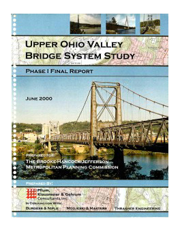
The recommendation for a new structure to connect West Virginia’s Northern Panhandle to the eastern Ohio shore dates back to the BHJ’s Upper Ohio Valley Bridge System Study, completed in 2000.
Subsequent phases of the study continued to contrast projected traffic volume and safety needs against the age and condition of existing bridges. That data made clear the need for a new bridge, which will encourage regional economic growth and allow the region to better retain existing business.
The bridge will also incorporate pedestrian and cycling routes that don’t exist in our region today. Currently, there is no shared-use route for cyclists to cross the Ohio River between Cincinnati and Pittsburgh, a distance of 322 miles.
The Brooke Pioneer Trail will run beneath the bridge. As part of the construction, the bridge will have a shared-use path (for bicycles and pedestrians) and the scope of project requires a connection between the trail and the bridge.
Flatiron the West Virginia Department of Transportation announced planned closures to the trail in late April, assuring outdoor enthusiasts that the trail would be open and in full use for Memorial Day and Memorial Day weekend.
Flatiron projects that crews will begin using the trail for access to the project site in August or September. The trail will be closed beginning in September, or as late as October, for wall installation.
If all construction goes as planned, the Brooke Pioneer Trail will reopen permanently in September 2019. Flatiron and WVDOT are coordinating for emergency use of the trail and will allow access for emergency services.
The connection to the bridge is important for the Brooke Pioneer Trail, as it will provide an opportunity for connection to trails and bikeways on the Ohio side of the river.
Project History
Phase I Report
The purpose of the Phase I Report was to analyze and determine the need for a new Ohio River Bridge crossing within an area extending from the former location of the Fort Steuben Bridge north of Steubenville, OH to the southern most end of Brooke County, WV. The study report was an outgrowth of the BHJ 2020 Regional Transportation Plan, adopted January 1998, that identified a new Ohio River Bridge as the top priority transportation project in the in the three-county region. PKG Consultants, Inc. completed the Phase I Report in June 2000.
- The Fort Steuben Bridge and Market Street Bridge are past their design life.
- A circumstance in which only one river crossing exists within the metropolitan area would create an unacceptable emergency response time situation.
- Due to inherent design characteristics, neither the Fort Steuben Bridge nor the Market Street Bridge can be updated to modern standards.
- Due to weight limits on the Market Street Bridge, the closing of the Fort Steuben Bridge would leave the region with only one crossing capable of carrying commercial truck traffic.
- Access to and from the Veterans Memorial Bridge is vulnerable to accident blockage and deficient intersection design.
- The concentration of all river crossing capacity within a small geographic area constrains the overall flexibility of the regional transportation system.

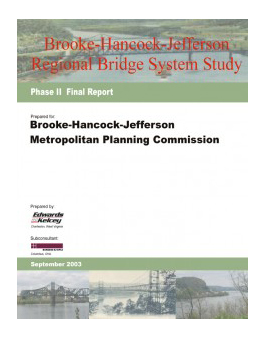
Phase II Report
Phase II, through a publicly-approved quantitative matrix, walked the community through logical constraints and benefits. It concludes with a consensus priority statement for bridge location and access improvements. In May 2003, the Brooke-Hancock-Jefferson Metropolitan Planning Commission formally adopted the priority statement.
To complete this Phase II study, various alternatives for bridge crossings were developed based on preliminary engineering analysis. Locations were identified that could facilitate east-west movements or to serve population and employment centers on each side of the River. These included replacing the existing bridges in their current location as well as two options for a new bridge in the southern portion of the planning area. These options initially formed seven scenarios including a Baseline, or “no-build,” option. Four additional scenarios were developed using a combination of bridge locations with northern and southern alternatives.

- Cover & Table of Contents
- Executive Summary Introduction
- Description of Study Area (Existing Bridges)
- Description of Study Area (Economic Conditions Pt1)
- Description of Study Area (Economic Conditions Pt2)
- Description of Study Area (Condition Analysis)
- Goals and Objectives
- Public Involvement Process
- Final Planning Process
- Final Recommendations & Project Priority
- Appendix A
- Final Complete Document (5.4 MB)
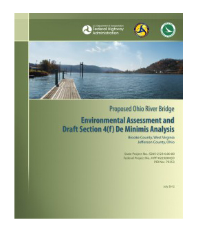
Phase III Report
This document provided an evaluation of anticipated environmental impacts associated with the construction of a new Ohio River Bridge for highway vehicles located south of Wellsburg in Brooke County, West Virginia and in the proximity of the unincorporated area of Brilliant, Wells Township, in Jefferson County, Ohio. The level of environmental documentation presented was an Environmental Assessment (EA). Alternatives considered in this EA included: the No-Build, Transportation System Management (TSM) and Build. The EA evaluated the anticipated socioeconomic, cultural and natural environmental impacts of the proposed project in accordance with the National Environmental Policy Act (NEPA) of 1969.

- Cover Page & Summary
- Table of Contents
- CH1 Purpose & Need
- CH2 Alternatives
- CH3 Environmental Effects
- CH4 Coordination
- CH5 Distribution List
- CH6 References
- Appendix A Agency Coordination
- Appendix B Public Workshop Comments
- Appendix C 4(f) De Minimis Impact Analysis
- Appendix D Draft Programmatic AGR Archaelogic Resources
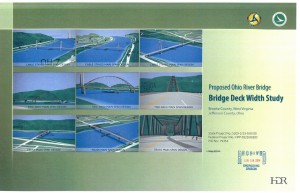
Deck Width Study Report
HDR Engineering, Inc. (HDR) conducted these studies and prepared this report with the primary objective of determining the relative cost of various deck width options for the Proposed Ohio River Bridge, generally referred to as the Wellsburg Bridge. This study report was based on the Alternative Crossing 8B alignment and configuration as shown in Appendix A (Sheets A-1 through A-3). Alternative 8B is the Preferred Alternative, as described in the Phase III Report.
Proposed Ohio River Bridge Deck Width Study, dated Received June 19, 2014

